An approaching storm system from the west has made for some photogenic, but dangerous weather conditions across Arizona today.
Earlier this afternoon, a severe thunderstorm over Cave Creek began to rotate, which prompted the National Weather Service to issue a tornado warning for the area. This was the first time in five years that the Phoenix office has issued a tornado warning.
Videos have surfaced on social media of the possible tornado, but the National Weather Service has not confirmed it yet.
Overnight, storms moved into the east Valley, dropping more than an inch of rain in parts of Mesa and Apache Junction. Rain has also recently fallen in Scottsdale, North Phoenix, and Surprise.
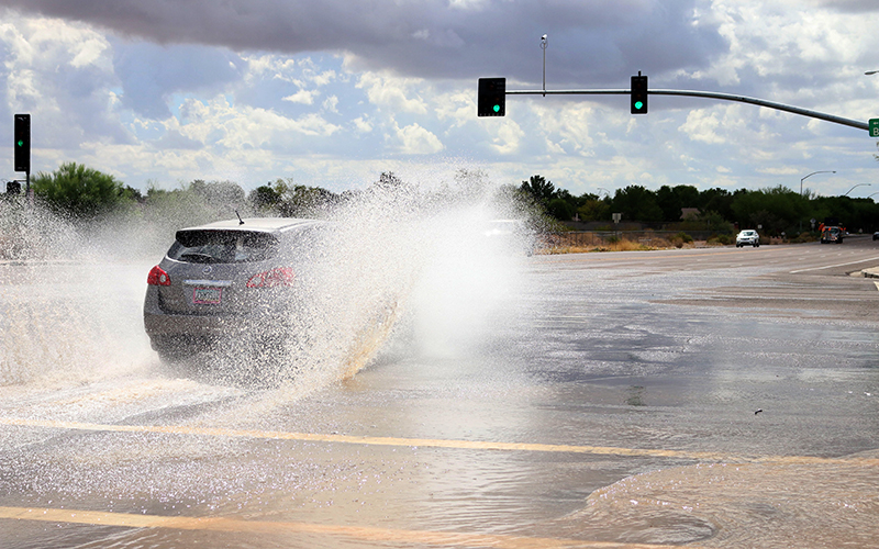
Mesa Fire and Medical have already rescued stranded drivers in their vehicles. The National Weather Service is also reporting street flooding in parts of Mesa, Apache Junction and Fountain Hills.
The National Weather Service has issued flash flood watches for a large part of the state, including metro Phoenix, Tucson and Kingman.
Flash flooding will not be the only concern with today’s storms. Thunderstorm activity is expected to pick up in the early afternoon over the Valley, and could last overnight. Meteorologists expect these storms will pose multiple threats, including large hail and damaging winds.
The Storm Prediction Center has placed all of Maricopa County, and parts of Pinal, Gila, Yavapai, Yuma, Pima and La Paz counties under a slight risk of severe weather. There is also an enhanced risk for La Paz, Yuma, and western Maricopa counties, including the city of Buckeye. This means these areas will be the most likely see severe weather.
These thunderstorms could produce large hail and damaging winds in excess of 60 mph, heavy rains and lightning. There’s also an isolated tornado risk for the enhanced risk area.
The atmospheric setup
Current analysis shows the system is positioned over the California and Nevada state line. The system is expected to track to the southeast towards Arizona, which will amplify storm activity throughout the day across the state.
Out ahead of it, rich moisture from the remnants of tropical storms Lorena and Mario, which were nearly parallel to each other, is fueling the atmosphere. Since the storms dissipated over the weekend, the remnant moisture has made its way north over Mexico and into Arizona.
Now an intense area of low pressure is tracking south over the Great Basin. The position of this low is allowing a lot of ingredients to come together to make for an active weather day.
The current atmospheric set up is similar to two previous severe weather events over Arizona. In late September 2014, an intense line of thunderstorms moved through the Valley and central Arizona bringing high wind gusts near 70 mph that damaged some of the terminals at Phoenix Sky Harbor International Airport.
In early October 2010, Phoenix saw its largest hailstone ever, at 3 inches in diameter – nearly the size of a baseball. This was a rare event for Phoenix, as hail this big primarily occurs over the Great Plains. This was also the same storm system where multiple tornadoes touched down in the high country, including one that damaged homes in Bellemont.
What you need to know
As hail the size of baseballs and tornadoes are extremely rare in Arizona, they’re not out of the question for today. It is important for you to have a plan of action in case severe weather strikes your area.
If a thunderstorm is approaching, make sure you have a safe and sturdy structure to shelter in. The National Weather Service also recommends to stay away from windows and avoid using corded electrical equipment. If you’re in a vehicle, safely drive to a sturdy structure for shelter.
Keep in contact with loved ones by creating a communication plan. Prepare your home by securing loose objects outside, and closing doors and windows.
Have extra batteries and chargers for your cellphone ready, incase you are to lose power. More safety tips about how to prepare for severe weather can be found here.
Most importantly, do not drive into flooded roadways. It only takes 12 inches of water to float compact vehicles.
Story by Jordan Evans, Cronkite News