|
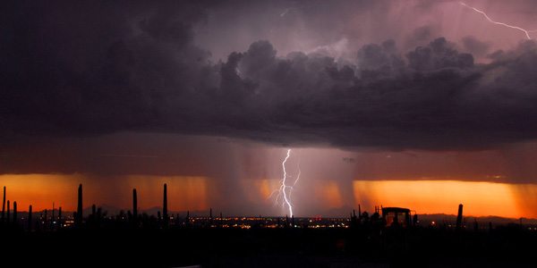
Monsoon season now brings more extreme wind and rain to central and southwestern Arizona than in the past, according to new research led by the University of Arizona. Although there are now fewer storms, the largest monsoon thunderstorms bring heavier rain and stronger winds than did the monsoon storms of 60 years ago, the scientists report. “The monsoon is the main severe weather threat in Arizona. Dust storms, wind, flash flooding, microbursts — those are the things that are immediate dangers to life and property,” said co-author Christopher Castro, a UA associate professor of hydrology and atmospheric sciences. The researchers compared precipitation records from 1950-1970 to those from 1991-2010 for Arizona. They also used those records to verify that their climate model generated realistic results. “This is one of the first studies to look at long-term changes in monsoon precipitation,” Castro said. “We documented that the increases in extreme precipitation are geographically focused south and west of the Mogollon Rim — and that includes Phoenix.” The region of Arizona with more extreme storms includes Bullhead City, Kingman, the Phoenix metropolitan area, the Colorado River valley and Arizona’s low deserts, including the towns of Casa Grande, Gila Bend, Ajo, Lukeville and Yuma. The Tohono O’odham Reservation, Luke Air Force Base, the Barry Goldwater Air Force Range and the Yuma Proving Ground also are in the region with more extreme monsoon weather. Tucson is just outside of the zone with more extreme storms. Having less frequent but more intense storms is consistent with what is expected throughout the world due to climate change, Castro said. “Our work shows that it certainly holds true for the monsoon in Arizona,” he said. When the researchers compared the results from climate and weather models to the actual observations, the model with a resolution of less than 1.5 miles accurately reproduced the precipitation data. The models with resolutions of 10 miles or more did not. “You just can’t trust coarser simulations to represent changes in severe weather. You have to use the high-resolution model,” Castro said. First author Thang M. Luong conducted the research as part of his doctoral work at the UA. He is now a postdoctoral researcher at King Abdullah University of Science and Technology in Thuwal, Saudi Arabia. The paper, “The More Extreme Nature of North American Monsoon Precipitation in the Southwestern U.S. as Revealed by a Historical Climatology of Simulated Severe Weather Events,” by Luong, Castro, Hsin-I Chang and Timothy Lahmers of the UA Department of Hydrology and Atmospheric Sciences and David K. Adams and Carlos A. Ochoa-Moya of the Universidad Nacional Autónoma de México, México D.F., was published July 3 in the early online edition of the Journal of Applied Meteorology and Climatology. The U.S. Department of Defense Strategic Environmental Research and Development Program and the Universidad Nacional Autónoma de México PAPIIT funded the research. The researchers wanted to identify risks from warm-season extreme weather, especially those to Department of Defense installations in the American Southwest. Existing global and regional climate change models don’t represent the North American monsoon well in either seasonal forecasts or climate projections, the research team wrote. Looking at the average precipitation over the entire monsoon season doesn’t show whether monsoon storms are becoming more severe now compared with 60 years ago, Castro said. |


