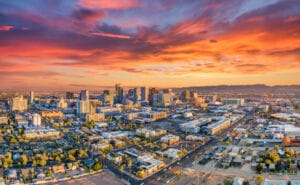

Tired of reading how Arizona might one day run out of water and become the 21st century version of the Dust Bowl? Then this story is for you. It offers hope, innovation and common-sense measures — but mostly it reveals how one Arizona State University professor is helping to monitor groundwater storage changes across the state, find new groundwaterwater and maintain water reserves at at a level that will ensure longevity, and fend off overexploitation.
LEARN MORE: Will water and capital concerns cool white-hot industrial market?
For more than a quarter-century, ASU Professor Jay Famiglietti and his research team have been working on a satellite system that he says can track groundwater supply changes and depletion from space via the NASA GRACE mission.
Famiglietti, a Global Futures Professor in the School of Sustainability, part of the College of Global Futures, said these satellites can map out regions of the world that are gaining or losing water on a monthly basis, as well as reveal long-term wetting or drying trends. Closer to home, Famiglietti said this can help the Grand Canyon state protect and identify vital groundwater supply and divulge how to better utilize it for future generations.
The award-winning scientist also hosts a popular podcast on Apple, now produced by Arizona PBS, called “What About Water,” which is about to launch its fifth season. The podcast aims to empower people and communities to connect water science with the stories that bring about solutions, adaptation and actions for the world’s water realities.
ASU News recently spoke to Famiglietti to discuss his work, research and what Arizona must do to protect its most precious resource.
Note: Answers have been edited for length and clarity.

Question: How do these satellites work and how long have you been at this?
Answer: I’ve been working with the NASA GRACE (Gravity Recovery and Climate Experiment) satellites since about 1997, which was five years before they launched in 2002. That gave me and my students a lot of time to prepare for the launch and to think about what to expect from the data and how we might use it to track water from space. We are still at it, now working with the second GRACE mission, the GRACE Follow-On mission (the original mission ran out of battery life in 2017 and the Follow-On launched in 2018), over 25 years later.
The two small satellites that make up the mission … move up and down in their orbits in response to how much water is, or isn’t, on the ground. For example, Arizona and the southwestern U.S. are in the throes of a megadrought and are literally losing water mass each month. The loss of water mass on the ground means that the region exerts slightly less of a gravitational tug on the satellites as they fly by, allowing them to float slightly higher in their orbits. The opposite happens, for example, when there is a large snowstorm in the mountains — the region has gained water mass, and the satellites are pulled a tiny bit closer to the Earth in response to the greater gravitational tug on the satellites.
By keeping track of the ups and downs of the GRACE satellites, which is done with incredible accuracy … we are able to map out the regions of world that are gaining or losing water on a monthly basis. Because we now have over two decades of GRACE data, we can also see the trends in changing water availability over the last 20 years.
Q: How has our groundwater in Arizona been used or misused in the past?
A: Arizona gets about 40% of its water supply from groundwater. That water is used in both municipal and rural water supplies. Outside of cities, much of that groundwater is used for irrigated agriculture. Like many states in the United States, and many regions around the world, water management has historically focused on surface water in our rivers, lakes and reservoirs. The need to manage groundwater has lagged behind by decades. … That means that there was a long history of the “Wild West” of groundwater use in both states. Specifically, there were no constraints on groundwater pumping, which led to significant overuse and depletion of aquifers in both states.
It may surprise people to know that, by area, less than 25% of the state of Arizona is subject to groundwater management. In the rest of the state … if you own the land and you have drilled a well, there are virtually no limits to how much groundwater you can pump.
This is problematic, and can lead to several negative environmental consequences, like causing rivers to run dry, driving a loss of biodiversity or causing the ground to sink (land subsidence). Importantly, overpumping in one region often leads to lowering groundwater levels beyond that region.
Q: Why are you optimistic about your technology now?
A: We are having a moment here in Arizona in which I feel like the stars and planets are aligned so that we can make great progress towards water sustainability in our state. Most imporantly, we have in Arizona Gov. Katie Hobbs someone who has made water a priority from day one of her administration.
We are also fortunate to have a core of dedicated researchers across the state, including our team at ASU, that received $40 million from outgoing Gov. Ducey to lead the state’s Arizona Water Innovation Initiative. The (initative) provides the funding base so that we engage deeply with state agencies to co-develop a research agenda to find those critical pathways to a sustainable water future for Arizona.
Finally, it is worth noting that … Arizona’s government water agencies are welcoming the opportunity to work together with us at ASU.
Q: Does groundwater ever get replenished or is it gone for good once we’ve tapped into it?
A: Groundwater may or may not be renewable, depending in part on characteristics such as how deep an aquifer is. Groundwater from aquifers that are close to the surface, or that are located adjacent to rivers, is generally renewable.
However, the water in deeper aquifers filled them on timescales ranging from thousands to tens of thousands of years ago, and more. Since water travels very slowly in Earth’s subsurface — say, a foot per day, per year, or even per decade — the water removed from these deeper aquifers will not be replenished on human timescales by natural processes.
Q: What can we do to improve the situation in Arizona?
A: One of the most important things that we can do in Arizona, across the entire state, is to understand how much water we have, how much we use and how these are changing over time. If we don’t know these things, it will be impossible to manage our water sustainably with future generations in mind.
We need to assess how much surface and groundwater we have, how much is available to us and how much of that is renewable versus nonrenewable. We need to know exactly how much water we are using and what we are using it for. We need to have a clear picture of how the aridification of the West is impacting our water supply, and to predict how the gap between supply and demand will change in the coming decades. Once we understand that gap, across the state’s watersheds, groundwater basins, irrigation or water management districts, then we can look at how to manage it moving forward.
As an outcome of the Arizona Water Innovation Initiative, along with our partners, we hope to identify a range of potential options for decision-makers and water managers — like tools in a toolkit. For example, these can include conservation, new technological advances in water monitoring and water-use efficiency and production, managed aquifer recharge, sewage recycling, desalination, policy interventions and more.