
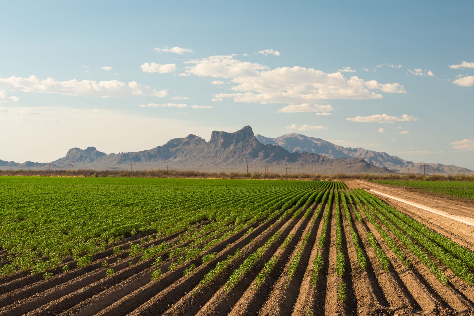
Farming in the U.S. has always been a test of endurance. Generations of growers have learned how to raise crops in one of the driest corners of the country, where every drop of water counts. Now, the way farming is done is changing. New tools are giving rural communities better ways to watch over their fields and make the most of scarce resources.
One of the most valuable of these tools is satellite imagery for data-driven agriculture. By turning pictures from space into practical information, farmers can spot problems early, manage water more wisely, and keep their land productive for years to come.
LOCAL NEWS: 100 best places to work and live in Arizona for 2025
INDUSTRY INSIGHTS: Want more news like this? Get our free newsletter here
Meeting the Challenges of Agriculture in the U.S. States
Farmers in Arizona work against some of the toughest conditions in the nation. Water scarcity remains the most pressing issue, with the Colorado River, responsible for supplying roughly 40 million people according to the US Bureau of Reclamation, at record lows after decades of drought. For growers in rural areas, this means every irrigation decision carries heavy weight.
Soil health is also under pressure. Continuous use of the same fields, coupled with limited organic matter, has led to compaction, erosion, and reduced fertility. Without intervention, this weakens long-term productivity.
Extreme weather adds another layer of difficulty. Summers are becoming hotter, and shifts in rainfall patterns make it harder to predict growing conditions. In 2023 alone, parts of Arizona recorded more than 40 days above 110°F, stressing both crops and workers according to the National Weather Service along with storms that become more frequent.
These challenges call for solutions that traditional methods alone cannot provide. This is where satellite imagery for agriculture is making a difference. By capturing detailed, field-level data from space, farmers can see how water, temperature, and soil conditions are affecting crops almost in real time. This technology offers not just a clearer picture of today’s problems, but also guidance for building resilience in the future.
How Satellites Support Smart Farming
Modern farmers in Arizona are turning to space for answers. Satellites orbiting hundreds of miles above Earth are not just taking pictures, they are reshaping how crops are grown and managed, offering tools that go far beyond what the eye can see.
- Crop Health Monitoring: Multispectral sensors detect changes in plant vigor using vegetation indices such as NDVI, or Normalized Difference Vegetation Index. It is a satellite-derived measure that shows plant health by comparing how much red light vegetation absorbs with how much near-infrared light it reflects. This allows growers to spot areas of stress, whether from lack of nutrients, pests, or heat, before damage spreads.
- Precision Irrigation: With water in short supply, satellite-derived soil moisture and evapotranspiration maps show exactly where irrigation is needed, cutting waste and boosting yields.
- Field Efficiency and Harvest Planning: By comparing images of agricultural land over time, farmers can track which fields are ready for cutting, harvesting, or replanting. This helps large-scale operations prioritize labor and equipment, reducing delays and ensuring timely harvests.
Take the example of Jaco Theron, an alfalfa grower managing thousands of hectares in rural Arizona. By studying weekly NDVI maps, he discovered that fields he thought were too dry were actually holding enough water. Adjusting his irrigation schedules saved hundreds of liters and improved crop performance. He also uses farm satellite imagery to see which alfalfa plots have been cut, making it possible to manage harvest progress without physically visiting each field.
Embracing Tech in Tradition
In Arizona, farming has always been more than an occupation. It is a way of life passed down through generations. While many imagine satellite-based tools as the domain of large industrial farms, small and mid-sized growers are now finding ways to bring this technology into their daily routines. Local authorities are working on making access to satellite imagery in agriculture far more attainable than it was even a decade ago.
How is that possible? With the help of local research programs, agritech startups, and state initiatives. For instance, the University of Arizona offers educational programs like the Graduate Interdisciplinary Program in Remote Sensing & Spatial Analysis. They develop remote sensing programs that combine them with robotics to design irrigation systems that adjust automatically to changing soil moisture levels, helping to conserve precious water.
Another example is not far away – in Marana. Cotton farmers are applying satellite-guided irrigation scheduling to balance high crop water demands with strict drought restrictions. Alfalfa producers across the state, managing thousands of acres, rely on weekly NDVI maps to decide when to cut fields and how to rotate crops efficiently.
A New Era for Arizona Farming
Farming in Arizona has never been easy. Generations of growers have had to work around drought, scorching summers, and poor soils just to keep their crops alive. Now, with satellite imaging in agriculture, they have a new set of tools that make those challenges a little easier to manage.
By combining hard-earned local knowledge with insights from space, farmers can plan how to spend limited water supplies, protect their soils from droughts, and decide when and how to harvest. For some of the locals, this is not the question of growing and earning more. This is an issue of survival and maintaining the farm for future generations. Arizona’s rural communities are showing how technology can strengthen both the land and the livelihoods that depend on it.