Information is the lifeblood of construction, and no construction professional worth their salt will say there’s such a thing as too much information. If information can help improve the pace of progress or the safety of the jobsite or the quality of the project, a builder will want it.
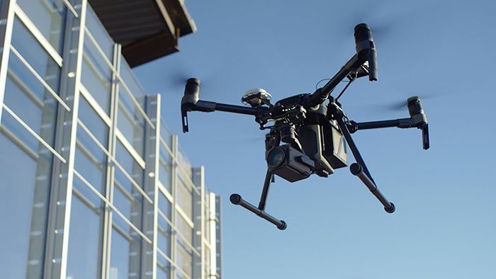
No technology currently in use in the construction industry can gather more information, quickly and safely than unmanned aerial vehicles, or drones. Drone technology is progressing at a rapid rate and builders are taking full advantage of it. Drones are used to gather a wide array of information, including site topography, project progess and quality control.

“The information we can provide to clients now includes detailed mapping and 3-D modeling, in addition to videos and still photos,” said Jason Wise, UAS program manager at Terracon. “Manned aircraft have always been able to provide aerial photography and mapping products, but unmanned aircraft are lower and cheaper, which means they can provide much more detail and fly much more often than manned aircraft.”
 Perhaps the most common use for drone technology is project monitoring and inspections. With a drone, builders can inspect all angles of a project on a regular basis to check on progress and quality.
“Nothing excites an owner more than being able to see their project underway at various stages, especially if they are unable to visit the job site on a regular basis,” said Wayne Bell, president, LGE Design Build. “Paired with site cameras that provide live feeds and are accessible from anywhere with WiFi or cellular coverage, LGE leverages drone technology to capture a 360-degree view of our projects.”
According to Steve Berry, BIM manager for Kitchell Integrated Services, these regular drone fly-bys to gather information also help builders track material usage and document where hidden utility lines are so they can quickly find them in the future. Berry also noted that there are smaller drones being developed that fly like a swarm, with several small drones moving together.
“If they do get smaller and smarter, that would be great to use,” Berry said. “Bring them in after hours when the site’s closed, you send them in on a path and they fly through a building, photographing everything. In one night you could have the whole thing documented. Then the next night, you could do the same.”
Project progress tracking is the most common use for drones, but they can also gather information on parcels of land before they are selected for development. Drones with LiDAR technology will fly over an area and scan the landscape. This technology can gather topographical information of the land, even if it’s covered in vegetation, to reveal any hidden issues.
“Unknown civil and earthwork requirements on a large site can be a large risk for both the project owners and the contractor,” said Josh Marriott, VDC/field solutions engineer for McCarthy Building Companies Southwest region virtual design in construction department. “Having LiDAR technology allows us to mitigate some of the risk on these projects.”
Once the site is selected and surveying is ready to begin, drones can provide surveyors with more data, which is then passed on to the builder.
“We use the software to drive the surveying process of a site,” said David Mettler, manager of construction technology for Renaissance Companies. “We will mark points in the field that we gathered our data of the topography from for estimating and share this with the surveyor so they use it in the construction process.”
Wise and Terracon are developing their own drone technology to generate 3-D models of rock formations so engineers can analyze the site stability, map large parcels of land for environmental work and produce thermal infrared photographs of buildings. Some thermal infrared technology is already in use by drones, who fly close to buildings and scan them to pick up any temperature changes caused by air leakage.
“We do a lot of hospitals, and leaking is not allowed in hospitals,” said Scott Root, managing executive at The Kapture Group in Tempe. “We go to the Nth degree to make sure the exterior cladding is put on perfectly, and the drone allows us to do that.”
Using this technology is not as simple as buying a drone, strapping on a camera and getting it up in the air. All drone pilots must be certified to fly. They cannot fly the drones over people or in busy airspace without permission. The pilot is required to keep the drone in sight at all times, which can be challenging around buildings.
Besides the practical challenges, drone technology is limited by short battery life, radio interference and mechanical failures. Plus, companies now have to come up with ways to analyze and store all of the data being gathered.
All of those issues are minor compared to the benefits companies are seeing from using drones in the field.
“Where the real advantage is right now in construction is safety,” said Root. “An example would be checking roof conditions. If you can get up there with a drone, you don’t have to send someone up there to actually inspect. You can get up there, investigate the condition and come up with a plan to solve whatever the challenge is. And do it without sending someone up on a lift or a ladder.”


